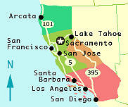
 Categorized by region:
 North
North
 Central West
 Central East
 South
South
GPS Gives you Wings!
This list of GPS Coordinates of most California hot springs, even devulges water temperatures and conveniently links to topo maps for the more adventurous types … GPS- California Hot Springs
When There's Fire & Rain in California
 FIRE WATCH June – Sept!
• Caltrans 1-800-427-7623 (road conditions)
• Latest California Fire Maps
Details: Unfortunately, Southern California often has high fire danger June – September. Drought and high winds can exacerbate this issue, and fires can spread with frightening speed. Always double check local sources about road conditions and fire dangers, during this season.
Caltrans is also a good resource year round, for road conditions. Highway 1, is one of the most expensive roads to maintain in the United States, since it often sits along the ocean. The cliff defying stretch along favorite tourist destinations, such as Big Sur, is more prone than most, to having problems with falling rocks, mudslides. fog. and floods, during winter.
When There’s Fire & Rain in California
 FIRE WATCH June – Sept!
• Caltrans 1-800-427-7623 (road conditions)
• Latest California Fire Maps
Details: Unfortunately, Southern California often has high fire danger June – September. Drought and high winds can exacerbate this issue, and fires can spread with frightening speed. Always double check local sources about road conditions and fire dangers, during this season.
Caltrans is also a good resource year round, for road conditions. Highway 1, is one of the most expensive roads to maintain in the United States, since it often sits along the ocean. The cliff defying stretch along favorite tourist destinations, such as Big Sur, is more prone than most, to having problems with falling rocks, mudslides. fog. and floods, during winter.
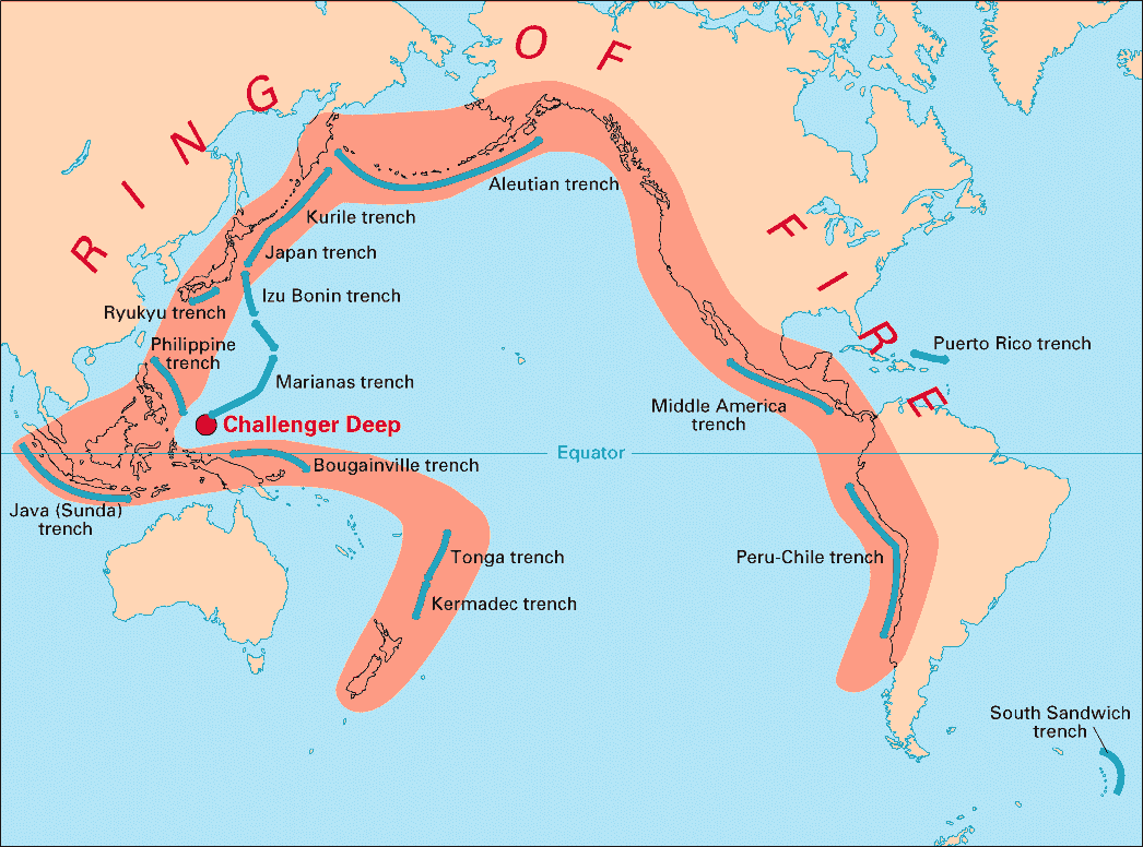
MAP – Pacific Ring of Fire
Hot springs locations, like life, make so much more sense when viewed from afar…
The ring of fire is home to 452 volcanoes (over 75% of the world’s active and dormant volcanoes) and 80% of the world’s largest earthquakes. No wonder there’s so many hot springs in these areas!
Do you have helpful info or advice regarding the Pacific Ring of fire, to satisfy the inner scientist or adventurer in us? If so, please share your knowledge!
Native Americans and Hot Springs
Native Americans have a long relationship with hot springs.There is evidence that many of the major hot springs in the Americas were visited and used by local native peoples. There are artifacts near some of these hot springs that support a history of human activity that extends back thousands of years. Native Americans revered hot springs as a sacred healing place.[1]The natural hot springs in Tonopah, Arizona are a prime example. The name “Tonopah” derives from the Western Apache name Tú Nohwá, meaning “Water For Us” or “Water For You”, Though there are no ruins or evidence of dwellings in the immediate vicinity of the hot springs, the prevalence of grain-grinding mortar holes, pottery shards, and other man-made objects in the area suggest that this site was frequented for many years by native peoples such as the Hohokam. The hundreds of very high quality arrowheads found near existing springs in Tonopah attest to its popularity as a hunting ground.Reference: wikipedia

